Let us form one body,
one heart,
and defend to the
last warrior our country,
our homes,
our liberty,
and the graves of our
fathers.
~Tecumseh, Shawnee
q |
| Violets - purple and white - were blooming all over Ohio. |
Our early morning drive to the Hopewell Culture National Historical Park* just outside of Chillicothe, Ohio confirmed the Google Map showing it was bounded by a prison on the south, a prison on the west and the Sciota River on the east. There is a field under cultivation on the north. A Veteran's Hospital stands nearby. How did this park/historical site/museum end up here?
We would find out.
 |
| The facility on the left is newer. The one on the right has large older buildings. It looks like something from an old movie. |
Fortunately for us (luck of the Irish, you know) we walked into the park building and into the care of CM. CM is a doctoral student in archaeology at the University of North Carolina and works at the park in the summers. She studies the Hopewell, specifically a site 50 miles to the south in Portsmouth, Ohio (and upon much of which the city is built). She was an amazing source of information and we monopolized her time as we attempted to soak up enough information about the Hopewell, Adena, and Fort Ancient peoples to guide our visits to sites and give our trip some focus/structure.**
There are really more questions than answers here. Modern archeologists are still theorizing, testing, and studying. They have old maps,*** early excavations (by amateurs and professionals), artifacts and what little remains of actual earthworks today. But modern tools have been developed that are shedding light on what areas remain.****
We were not going to answer any questions, but to learn a bit and experience these sites. We would eventually travel to five sites. Our introduction to what exists - current site maps, the old Squire and Davis maps, the history of digs and development, artifacts in the park museum, photos of other artifacts, and personal observation all filtered through CM's information would help us know where and how to look. We would note the locations on the Sciota River system. We would see the reconstruction of some mounds. And we would travel to sites with remaining, relatively undisturbed earthworks.
Even before we stepped outside to view Mound City, we learned these builders had some kind of trade established as they had raw materials and artifacts of copper, mica, obsidian, shark teeth, shells that are not found in Ohio, but from as far away as Wyoming, the Gulf Coast and the Atlantic Coast. Their construction showed they understood geometry and astronomy. The burials found in some mounds indicated the importance of ritual and honoring the dead. We knew we would be walking on sacred ground.
I won't sound too scholarly - I'll leave that to the scholars, but I would like to leave readers with an appreciation of the scale and complexity of the earthworks and sacred sites we were able to see and experience. This was a sophisticated and skilled civilization. And then something happened about 500 BCE and they stopped building earthworks.
I also want to share my respect for the people who are trying to answer the questions raised by the remnants of this culture and my appreciation for what has to have been and must continue to be the challenge of saving and studying these sacred sites. It is a varied group of stakeholders involved including the American Indians/Native Americans/first people (different people prefer different names) who trace their ancestry and heritage to the Hopewell (the Shawnee especially play an active role in the efforts to save and stabilize Hopewell sites). Other stakeholders include archeologists, the U.S. Government, the State of Ohio, the Ohio Historical Connection and Arc of Appalachia.*****
Mound City
The only completely reconstructed site, Mound City can be accessed just beyond the park building/museum/shop. An interpretive trail leads you through the site. We walked quietly and read the informational signs and moved down to the river. There were maps at the stairs to the river walk - these signs made is clear how the mounds had been "disappearing" over the years.
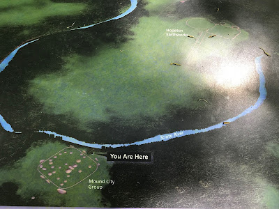 |
| We squinted hard as if we could really see the Hopeton Earthworks almost a mile beyond the river. |
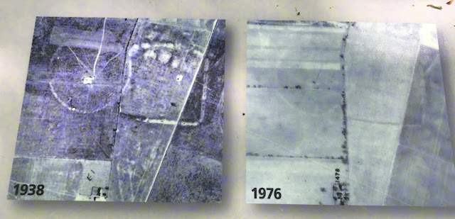 |
| Aerial photos provide an example of how farming destroyed sites. |
The federal government built a prison south of the park (where Ohio now operates a maximum security prison including death row). Across the road is one of Ohio's medium security prison. North of that prison is a Veterans' Hospital.
The museum that is part of the park visitor center is remarkable in that it contains artifacts from the site (some of which I share below).
 |
| Of course there would be ceramics. |
 |
| An effigy pipe - this is the only frog we saw in Ohio. We heard many while hiking, but couldn't get a recording. |
 |
| Another effigy pipe |
 |
| Obsidian (from Wyoming) spear point. Was it a ceremonial object? |
 |
| A mapped example of astronomical alignments with some earthworks. |
 |
| My poor attempt to capture the site. |
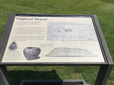 |
| One of the signs - part of the interpretive trail |
 |
| Heading to the river. |
Upon reaching the far side of the enclosure we headed down to the river observing birds and wildflowers. A robin hopped ahead of us on the path.
 |
| Our little robin preceded us on the path. We stopped at the bench and ate lunch before we headed off to Hopewell Mound Group just a few miles to the west. |
 |
| It is a lovely peaceful spot there on the banks of the Scioto River. |
 |
| A reproduction of Squire and Davis map showing the numerous sites along the river. |
 |
| I was trying to capture the crazy flying insects that flew up as we walked along. |
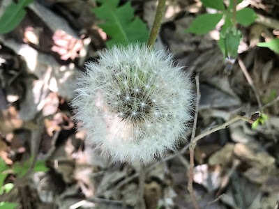 |
| We knew we were late for the wildflowers, but dandelions will out. Even in the manicured grass, they bloomed and went to seed. |
 |
| Photographed from outside the enclosure wall. |
 |
| Sweetgum pods against the sky. |
Hopewell Mound Group
CM had shared that there is an section of original enclosure wall at Hopewell Mound Group that she found to be a special place. We decided to go and see what we thought about it.
The most direct route was blocked by emergency vehicles. We detoured around and discovered it was some kind of a drill. Then we reached the site and realized we had misjudged the size of the place. The interpretive trail here is over 2 miles long. We quickly realized that the length of the trail, the lack of shade, and the warmth of the day were all working against us.
So, we decided to drive around and see if we could get a little closer. When we also found the road was blocked by utility workers, we took it as a sign that we were done for the day.
I can say that this site, cleared of almost all signs of the Hopewell, was stark and sad. But the wildflowers bloomed in the grassy field and the Red-winged Blackbirds feasted. I've never seen so many of these lovely birds.
 |
| It was a drill. |
 |
| We would see different varieties of violets blooming wild everywhere. |
 |
| DH is pointing to the tree line where we want to be. It's a long way across that field. |
 |
| What do you do when the sign wants you to go the wrong direction? |
 |
| One RWBB showing off. |
 |
| Sign at the entrance to the park. |
*Park - https://www.nps.gov/hocu/index.htm
Hopewell tradition - 200 BCE to 500 CE - https://en.wikipedia.org/wiki/Hopewell_tradition
Hopewell sites - https://en.wikipedia.org/wiki/List_of_Hopewell_sites
** So if you are interested in doing something like this, do some research before you arrive. I'm STILL researching. And if you are going hiking, bring insect repellent...more on that later.
***Thank heavens for the early work of E. G. Squire and Ephraim Davis who mapped the Hopewell. https://en.wikipedia.org/wiki/E._G._Squier
****http://theconversation.com/six-tools-that-are-revolutionising-archaeology-by-helping-us-find-sites-without-digging-51826
Check out LIDAR one Hopewell sites in Ross County, Ohio. http://ohioarchaeology.org/resources/39-resources/research/articles-and-abstracts-2008/262-lidar-analyses-of-prehistoric-earthworks-in-ross-county-ohio
*****We have become involved with Arc of Appalachia through the Highland Wildlife Sanctuary, Serpent Mound, and Hocking Hills State Park where there is an effort to save an adjoining parcel of land called Fern Gully. http://arcofappalachia.org/fern-gully-campaign/
Brochures:
Mound City - Everything you want to know about this site is here including a map of the site. https://www.nps.gov/hocu/learn/historyculture/upload/MCG-Site-Bulletin-5-REVISED.pdf
Hopewell Mound Group - This place is enormous, but you must use your imagination. https://www.nps.gov/hocu/planyourvisit/upload/HMG-Site-Bulletin-2010-NON-EN.pdf
Lots of other stuff that you might find interesting (Remember that this information is fluid as discoveries happen!):
Different groups of moundbuilders:
Adena Culture – 1000 to 200 BCE
Hopewell Culture – 200 BCE to 500 CE
Fort Ancient Culture – after 500 CE 1000 to 1750 Flourished
Thought to have been an expansion of the Mississippian
cultures
it is now accepted as an independently developed culture that
descended from the Hopewell culture. The Fort Ancient Culture's
most famous mound is called the Serpent Mound -
https://www.ohiohistory.org/visit/museum-and-site-locator/serpent-mound
(see also Alligator Mound - http://www.ohiohistorycentral.org/w/Alligator_Mound)
Mississippean Culture – 800 CE to 1500 CE
Important symbols that may provide insight into shapes of some mounds:
Underwater Panther - https://en.wikipedia.org/wiki/Underwater_panther
Serpents - https://www.warpaths2peacepipes.com/native-american-symbols/great-serpent-symbol.htm and https://www.warpaths2peacepipes.com/native-american-symbols/serpent-symbol.htm
FINAL NOTE: This was the second attempt at writing this post. My computer ate the first one. I'm not really sure which is/was better. But I did a little more research for this one and will probably do a little more before our next trip to Ohio.


Wow! Okay, now you have me ready to sign up. It's going to be a very busy fall. <3
ReplyDelete