 |
| Reflections on the water |
Always be on the lookout for the presence of wonder.
When I was younger - much younger - I kept count of how many times I walked the river/cliff trail each day (and during the entirety of each visit). It was as if the number of trips told the story of the quality of the vacation, more trips = better stay.* It was a way to quantify the happiness, I guess. And I suppose we did that with float trips as well. How many times did we float the river each day?**
I still find myself wanting just one more walk. I believe we walked our little bit of the river 3 or 4 times this trip. There was (and still is) always something new to see along the trail with each walk. And the trail continues to change from visit to visit (like the river does). Boulders shift, the cliff face falls, trees sprout, trees die, live trees fall over, dirt is washed away and new tree roots are exposed. Maybe I notice more now as I take the trail slowly. It is narrow and uneven in places. A fall would not be a good thing.
The trail is different at sunrise and sunset and noon. And it always depends on the destination.
Most of the longer trips started from the top of the cliff.*** Here are the trips in no kind of order. I will try to let you know when I turn back or take a different branch of the trail. My photos seem to download weirdly. Sorry.
So, let's take a couple of walks.
I. The first walk
The rule is that first you unpack the
car, then you go to see what the river is like.
And so we did.
 |
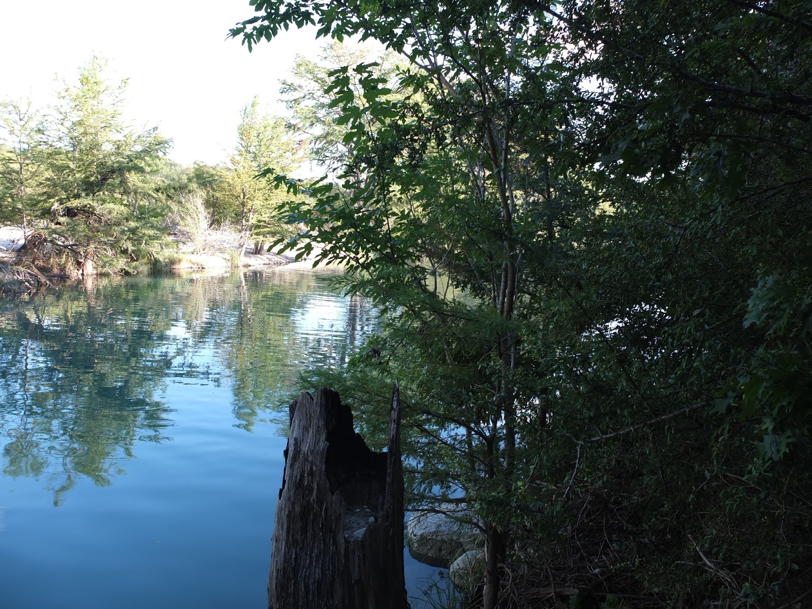
| Looking from the shallows upriver. You can see the shallow rock-lined area and the darker-deeper water beyond. |
 |
| A little rock pool at the rapids. Note the piece of trash. We spent some time picking up trash along and in the river. |
 |
| Cypress knees at the swimming area. Across the river are piles of driftwood and junk from the Memorial Day weekend flooding. |
 |
| A look at the "middle" set of rapids. We played a made-up game called "dinky men" and stacked rocks here. This set of rapids comes and goes. |
 |
| Boulders, cypress knees, and giant trees. This shows three of the big ones. |
 |
| The river path heading downstream. This area is alive with lightning bugs at dusk (and the grass is full of Trombiculidae, aka red bugs, aka chiggers - which love me and which I hate). |
 |
| The storm waters got up some 5.5 feet above the trail as this organic material was at my face level in a small tree on the riverbank. |
 |
| Looking downriver towards the cliff. Note all the rocks above the surface. This makes for interesting floating. |
 |
| This acorn should be on another post, but I am lazy and leaving it here. |
II. Mid-afternoon
 |
| Looking up river from the top of the cliff.**** |
 |
| And across the river. The clouds were like cartoon clouds - all weekend. |
 |
| Looking down from the upper trail to the lower. You can just see the boulders in the water. |
 |
| The trail ducks under a rock outcropping (we call it the nose). |
 |
| Looking back along the upper trail. |
 |
| In places the trail is slanted and the trees lean out towards the river. This can be disorienting. |
 |
| Another section of the upper trail. |
 |
| Some spots along the trail are becoming more and more difficult. |
 |
| One of the many dead trees along the river. |
 |
| Looking back along the uneven upper trail. |
 |
| It is a short walk along the upper trail to the transition to the lower trail. |
 |
| Another look back before "jumping/climbing/scooting" down. |
 |
| The trail below - to the right is a path to the foot of the cliff and another to the edge of the river. Good places for fishing and exiting a float abound along this section of the river. |
 |
| The trail below to the left leads on to the lower campgrounds, more rapids and stately old cypress trees. It is only four feet from the bottom of that tennis to the "next step," but the path then falls off quickly in both directions. It wouldn't be wise to jump. |
 |
| Normally it would have been difficult to stand, look down, and take photos, but I have done some "balance" work of late. I still sat and eased myself down the drop. |
 |
| Just upstream you can see the set of rapids that used to be pretty strong and scary. |
 |
| I decided to walk downriver on the lower trail first. |
 |
| There was once a large, flat-topped boulder in the main swimming area. After one flood it had moved downriver some 50 yards or so. I still look for it along the river. This one is the right color. |
 |
| There are many boulders that have fallen from the cliff that abuts the trail. |
 |
| I think this is the the same group of boulders seen from below. |
 |
| A view downriver. |
 |
| Just a little way further down the trail. |
 |
| Now we move upriver. Pay attention as the trail is uneven. |
 |
| The lower portion of the cliff. You can just see the upper trail through the growth. If one HUGS this cliff and moves downriver another path leads to the cliff. |
 |
| Moving back upriver. This is almost the last of the wilder part of the trail. |
 |
| The trail begins to open up. The end of a tree can be seen almost crossing the trail. This tree has been down for some time and was crossing the trail, until recent floods moved it. |
 |
| You can see where the bark was peeled away, maybe in the flood waters... |
 |
| A branch showing some scraping. |
 |
| Cypress line the trail as it opens into the campgrounds. |
 |
| Looking back shows some of what remains from the spring flooding. |
 |
| Now we have reached the giants. |
There were many people on the river and I chose to skip the swimming area as it was too cluttered. Another walk will show the trees at the shallows.
 |
| At the end of the trail is Buffalo Creek. We all played there a little, but mostly it was my brothers and PJ getting wet and muddy there. Quite a few large trees grow along the banks of the creek. I am standing near where it joins the river proper. It is possible to walk along the bank, but I am too old to risk sliding into the creek. |
 |
| A view of the confluence of Buffalo Creek and the Frio (creek to my left, Frio straight in front). The afternoon light was still too bright for a good shot upriver. |
 |
| It wouldn't take too long for the sun to drop behind the hills. For now it winked at me through the oak leaves as headed away from the river towards our cabin. |
III. Morning walk
Early morning is really the time to walk the trails and see the river unimpeded by others. I don't begrudge others' use of the river, but I do get a little put-out by those who interfere with the peace of their fellow campers/tubers/swimmers (the loud voiced, screamers, players of loud music, litter bugs...go somewhere else. Maybe the Guadalupe is calling you!). I enjoy the quiet of the early morning. [You generally see more wildlife - deer, fish, birds, squirrels etc. And you can see and photograph without the brilliant colors of swimsuits and tubes and ice chests in the way.]
 |
| Looking upstream from the cliff. |
 |
| Sunrise on the cliff. |
 |
| This appears to be the way down to the cliff from the upper campground. |
 |
| A different view from the cliff. |
 |
| DH looking down. |
 |
| Looking down the cliff face - the green is foliage on the left is at the spring. |
 |
| This group of boulders atop the cliff create a small cave. I once climbed down to discover 3 -5 black squirrels***** here. I had never seen a black squirrel in Texas and had to look them up. sure enough they exist (they are called rock squirrels) and they were here. I have only seen them once, but look for them every time I am on the cliff. |
 |
| It is possible to walk along the cliff to the next property and get to their swimming, rope swinging, spring fed area. We have enjoyed it in the past, but not this trip. |
 |
| The morning sun lights up the trail. |
 |
| One of my favorite spots is the nose. This triangular boulder is a fairly recent fall. I suspect the drought has cause increased rock falls. |
 |
| River off the upper trail. |
 |
| It is so lovely at this time of day. |
 |
| Heading towards "the jumping off" point. |
 |
| At the jumping off point. |
 |
| Here we go. |
 |
| Checking for fish |
 |
| Plants will find a quarter inch of dirt - this looks like some kind of nettle (waiting for me). |
 |
| Not sure what this was either - small fruit on a shrub. |
 |
| The sunshine really points out the rugged trail. |
 |
| Upriver - the once wild rapids. |
 |
| Almost to the swimming area |
 |
| We were headed upstream, but turned back to remove cording someone had tied around a tree. |
 |
| At the rapids. |
 |
| DH moving towards more of the giants. |
 |
| Looking back down river. You can see the cliff if you look hard. |
 |
| Often fishermen hang out here. |
 |
| Continuing upriver. See where the dirt has been washed away from roots...just a little hazard on the trail. |
 |
| This is what we called the "dinky man" rapids. The dam is often down or under water. |
 |
| I stacked rocks the night before. DH bet they would be gone in the morning. |
 |
| He was wrong. |
 |
| The sunset released one ray that night, but we had no camera. Nice of the sunrise to give us a good view. |
 |
| The swimming area. |
 |
| The shallows (looking upriver) |
 |
| One of the giants. |
 |
| The swimming area. |
 |
| The current rope swing. |
IV. Walk to the foot of the cliff...
Well, I cannot end without going to the foot of the cliff. This was a strange little walk, but I continue to try to see everything I can. I keep thinking that this may be our last trip. The property is for sale and there is no telling what may happen. We may find other places to vacation. We will find other walks. But while we discover and wonder, we will only have these memories here.
 |
| Walk downriver. The riverside path will stop and you have to hug the wall of the cliff. |
 |
| I think this is where on path goes into the river and the other to the wall. |
 |
| Yeah, crumbly and scary wall. |
 |
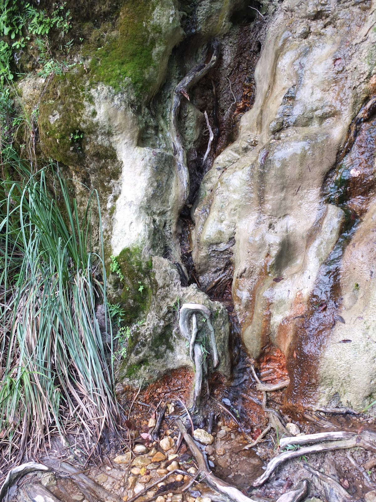
| And you are at the base of the cliff with boulders and roots at the river. The water pooling at the roots is coming from a spring. |
 |
| The spring trickles down this side of the cliff face. This is where people have climbed up in the past. I think I might have tried it once. |
 |
| There are some hand- and footholds all the way up. But it is dangerous. |
 |
| I initially came to see if the trail would make it and if the maidenhair fern was growing. The spring - so active - was a surprise. |
 |
| I loved this reflection of the trees. |
 |
| See the boulders just off the bank? |
 |
| These boulders and roots make it easy for tubers to stop here. |
 |
| The maidenhair fern was indeed growing - it loves the moisture. It is another of my mother's favorites. |
 |
| There were a number of green things enjoying the spring. |
 |
| Another bit of maidenhair. |
NOTES:
*And some walks were a competition...who could get to the upper level of the campgrounds first. One of us would run the trail and the other would go by the road. The trail runner always won unless there was someone in the way or a damp spot that prevented an easy climb. There is one spot now that I can only descend. I can climb it with a boost, but the hand-hold that allowed ease in climbing is gone now and I cannot work around it without help.
**We also do this with number of years we have been to the river. We started when my baby brother was born. So, it should be 53, but we missed one year when hurricane Celia came through (1970). We had to stay home and clean up the mess...lots of wind damage. We have made up the missing trip going twice a year a couple of times now, but it is still 52 years on the river...since 1962.
***One can access the cliff from above - a trail from the cabins/hotel units, from the river trail along the upper portion, or from the base of the cliff. The property owners were concerned about folks scaling the cliff face as it is not a safe climb for most. The spring is now flowing and the whole area pretty slick. [This continues to be a major concern for many property owners along the river - folks floating through climb out and can get injured on their property, hence there are many "No trespassing" signs all along the river.] This summer a guard was posted to keep folks from climbing up the cliff face.
****On a good year, the water below the cliff is deep enough for a jump. Yes, I have done it a few times. We always check for depth and hazards (boulders and/or stray junk). There have been many years we decided it was too dangerous and watched other dare devils jump anyway. This year it was fairly shallow below the cliff. We did not jump.
***** Rock squirrel information - http://www.nsrl.ttu.edu/tmot1/spervari.htm
Other photos - don't know where they go, but will keep them here anyway.
 |
| See the fish? |
 |
| It is about a 12 inch bass. |
 |
| Here's that rock again. I think the other was a different shape, maybe a little longer... |
 |
| Along the trail, but I am not sure where. |
 |
| It all looks like it could fall at any moment. |
 |
| Tree trunk showing where debris brushed past it in the floods. |
 |
| A "getting out" spot. |
 |
I said I was watching the boulders...
|
 |
| This boulder is like a table. A tree grows at each end. |
 |
At the other side.
|
 |
Of course this side is just a stump (seen in other trail photos).
|
 |
Look at this river.
|
Finally, I will note here that the waterfall just upriver from where we stay was destroyed between Memorial Day and Labor Day. We had judged it hazardous during our May visit and warned folks about it. But we were surprised to see it was totally gone in September. We suspect this was not the work of the floods, but the work of man (or woman). This is the second small "falls" removed from the river in recent memory. It is sad that a river cannot be a river. That's all.


No comments:
Post a Comment
Thanks for coming along on the walk. Your comments are welcome.